


Bevill St Tech Voting District, Walker County, Alabama
About
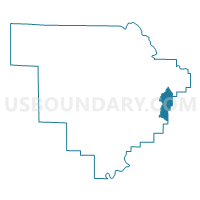
Outline

Summary
| Unique Area Identifier | 523042 |
| Name | Bevill St Tech Voting District |
| County | Walker County |
| State | Alabama |
| Area (square miles) | 12.17 |
| Land Area (square miles) | 12.13 |
| Water Area (square miles) | 0.04 |
| % of Land Area | 99.64 |
| % of Water Area | 0.36 |
| Latitude of the Internal Point | 33.74957420 |
| Longtitude of the Internal Point | -87.04709380 |
Maps


Graphs
Select a template below for downloading or customizing gragh for Bevill St Tech Voting District, Walker County, Alabama


Neighbors
Neighoring Voting District (by Name) Neighboring Voting District on the Map
- Argo Fire Department, Walker County, AL
- Bagley Junior High School, Jefferson County, AL
- Dillworth Community Building, Walker County, AL
- Dora Civic Center, Walker County, AL
- Empire Union Bldg, Walker County, AL
- Twilly Town Church, Walker County, AL
Top 10 Neighboring County Subdivision (by Population) Neighboring County Subdivision on the Map
- Dora CCD, Walker County, AL (7,794)
- Robbins Crossroads CCD, Jefferson County, AL (5,902)
- Quinton-Wegra CCD, Walker County, AL (1,484)
Top 10 Neighboring Place (by Population) Neighboring Place on the Map
Top 10 Neighboring Unified School District (by Population) Neighboring Unified School District on the Map
Top 10 Neighboring State Legislative District Lower Chamber (by Population) Neighboring State Legislative District Lower Chamber on the Map
- State House District 15, AL (48,965)
- State House District 14, AL (40,597)
- State House District 13, AL (39,882)
Top 10 Neighboring State Legislative District Upper Chamber (by Population) Neighboring State Legislative District Upper Chamber on the Map
Top 10 Neighboring 111th Congressional District (by Population) Neighboring 111th Congressional District on the Map
Top 10 Neighboring Census Tract (by Population) Neighboring Census Tract on the Map
- Census Tract 115, Jefferson County, AL (5,902)
- Census Tract 217, Walker County, AL (4,085)
- Census Tract 218, Walker County, AL (3,709)
- Census Tract 216, Walker County, AL (1,484)